Categories
NC500 Northwest Highlands Walks and Treks

Unsere Top 4 Berge im Nordwesten Schottlands

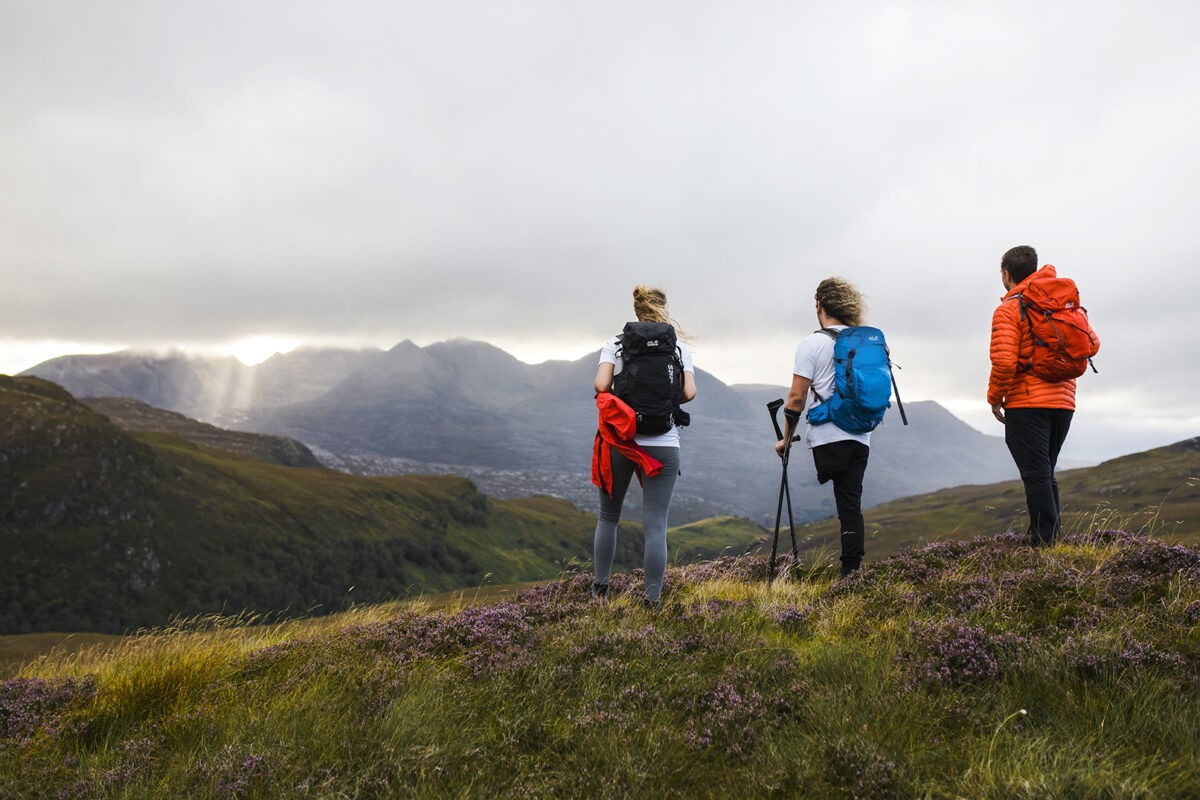
Nach langjähriger Erfahrung als Wander-Guide im wilden Nordwesten Schottlands haben sich die folgenden Wanderungen als meine Top 4 Wege bzw. Bergbesteigungen herausgestellt.
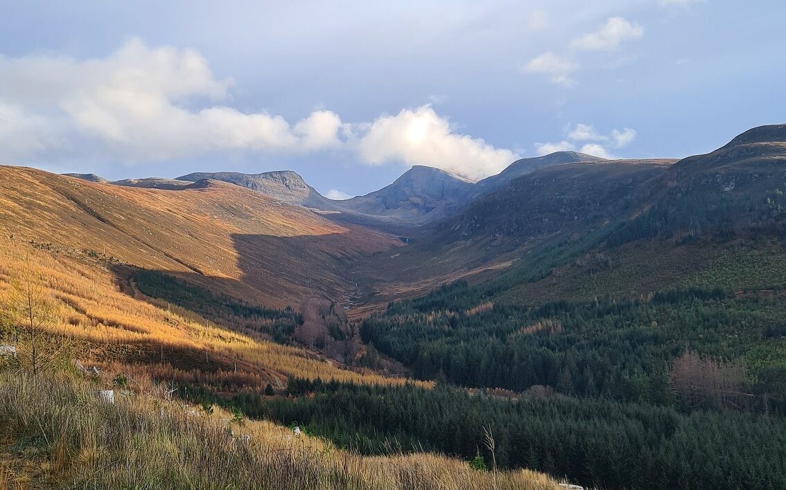
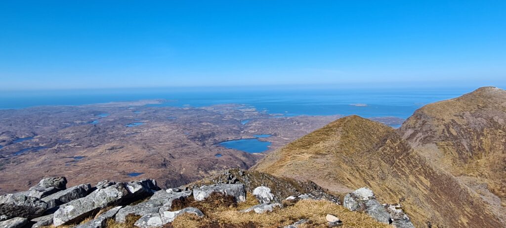
Quinag

Quinag ist ein 808 m hoher Gebirgszug in Sutherland, der nur 40 Autominuten nördlich von Ullapool liegt.

Es handelt sich nicht um einen einzelnen Berg, sondern um eine dramatische Gipfelkette, die auf Schottisch-Gälisch Sàil Gharbh, Sàil Ghorm und Spidean Coinich heißt. 

Der Quinag ist insofern ungewöhnlich, als er dem normalen Wanderer nicht weniger als drei einzelne Gipfel über 2.500 Fuß (Corbetts) bietet – eine Tour zu allen Gipfeln ist ein ziemlich großes Unterfangen. Das bedeutet, dass dies kein einfacher Tagesausflug ist, wenn man alle drei in Angriff nimmt. Aus diesem Grund nehmen wir nur zwei in unsere Tagesroute auf, um sie für die meisten erreichbar zu machen.

Ihre Anstrengung wird mit atemberaubenden Ausblicken auf Loch Assynt im Süden, Conival und Ben More Assynt im Südosten und Loch a’Chàirn Bhàin belohnt.

Details zur Wanderung: 12 km – Aufstieg 800 m, Abstieg 800 m – Gehzeit 5 – 6 h

Taken from the ridge of Quinag.

Ben More Assynt und Conival

Ben More Assynt und Conival sind die einzigen Munros in Assynt (Berge über 3000 Fuß/915 Meter).

Es handelt sich um zwei felsige Berge, die durch einen feinen Bergrücken miteinander verbunden sind und zusammen einen anspruchsvollen, aber lohnenden Tagesausflug über unwegsames Gelände bieten.

Von den Gipfeln aus eröffnen sich fantastische Ausblicke auf eine abgelegene und bemerkenswerte Landschaft in einem geologisch faszinierenden Gebiet des nordwestlichen Hochlands. Der Ben More Assynt, übersetzt “Großer Berg von Assynt”, ist mit einer Höhe von 998 Metern der höchste Punkt in Sutherland.

Diese Berge haben Kultcharakter und sind ein Muss für Munro-Fans und Liebhaber wilder Gebiete. Ein wunderbarer und unvergesslicher Tagesausflug in einer atemberaubenden Gegend von natürlicher Schönheit.

Details zur Wanderung: 17,25 km – Aufstieg 1075 m, Abstieg 1075 – Gehzeit 8,5 – 9,5 h
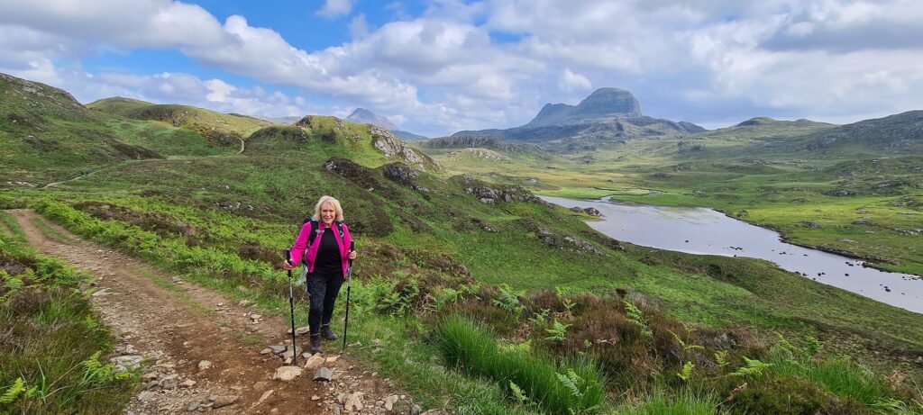
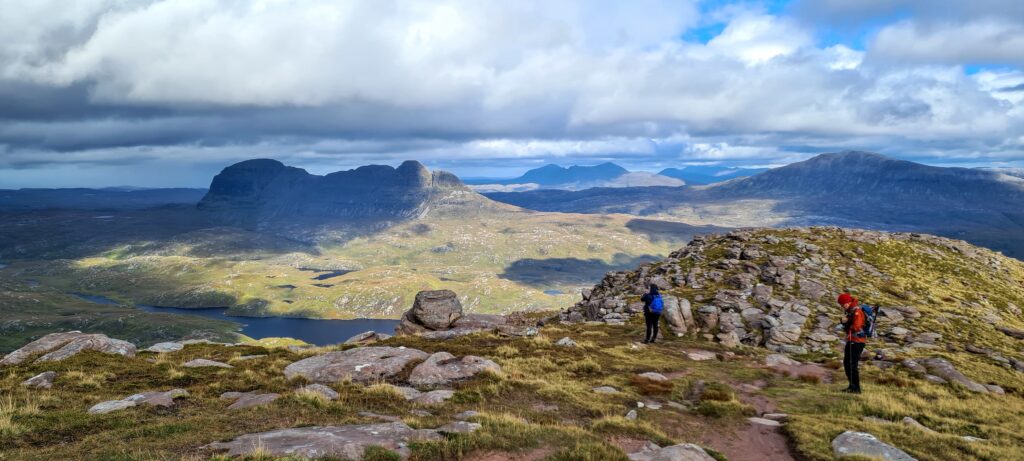
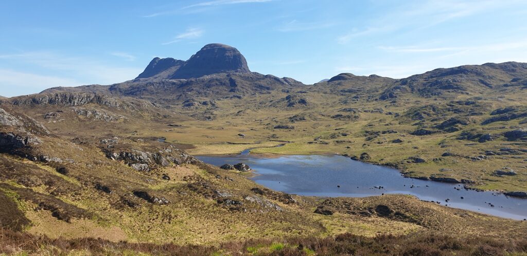
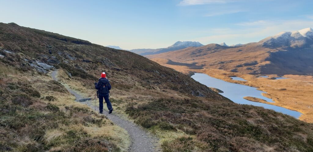
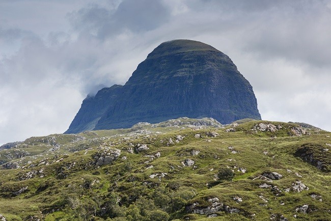
Suilven

Dies ist eine inspirierende Art, diesen herrlichen Berg zu besteigen.

Suilven ist zwar nur 731 Meter hoch, aber seine bemerkenswerte Silhouette macht ihn zu einem der bekanntesten und am leichtesten zu identifizierenden Berge Schottlands.

Seine Lage im Herzen der Cnoc-and-Loch-Landschaft von Assynt und die herrliche Aussicht machen ihn zu einem der schönsten Gipfel Großbritanniens.

Der Rückweg erfolgt auf der gleichen Route, die wir hinaufgewandert sind.

Details zur Wanderung: 19,5 km – Aufstieg 750 m, Abstieg 750 m – Gehzeit 7 – 8 h
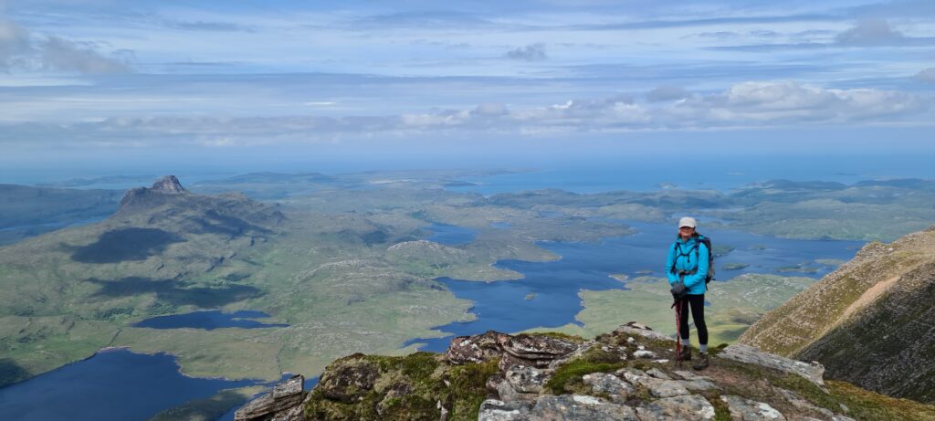
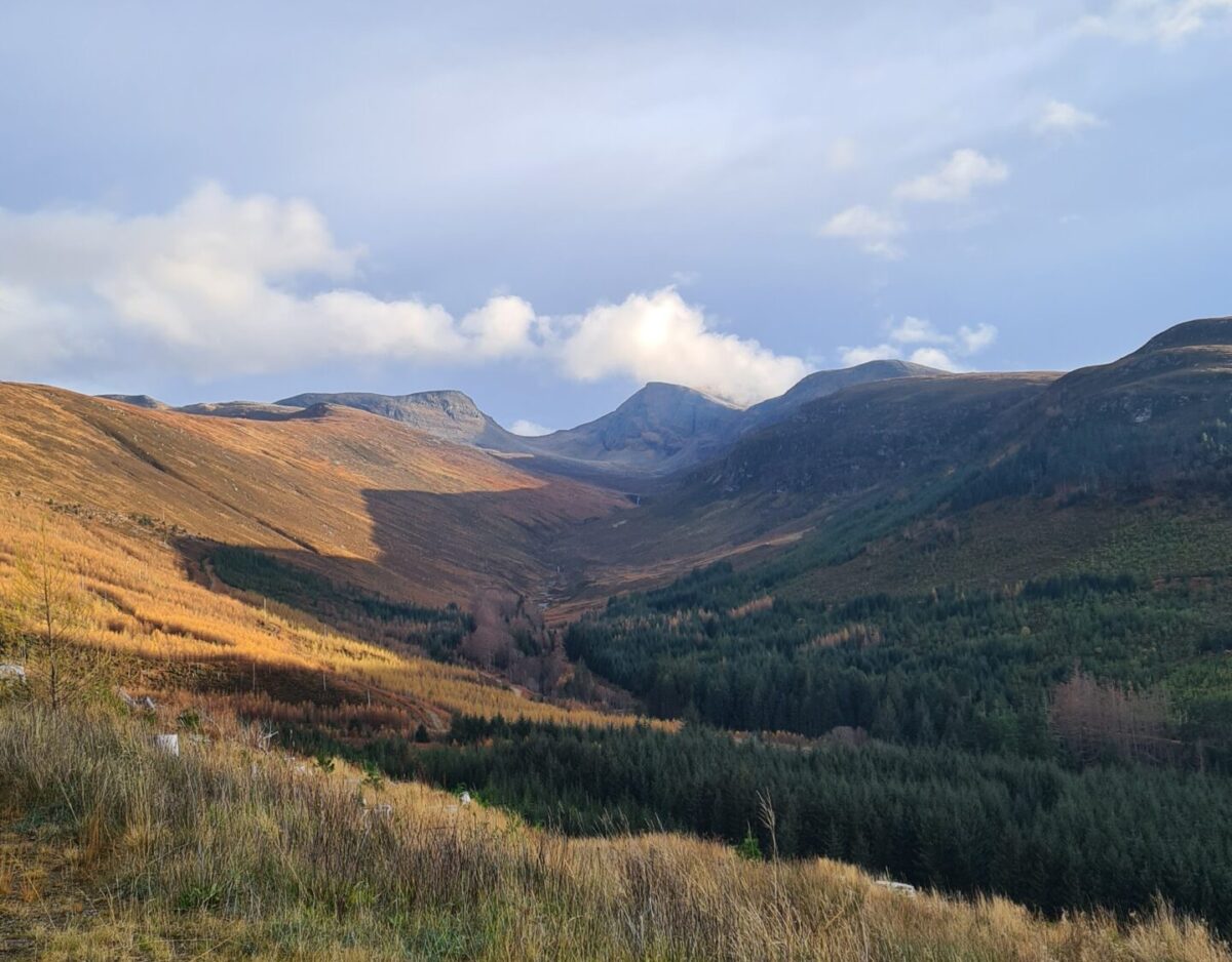
Suilven seen from the path to Glencanisp Lodge

Cul Mor

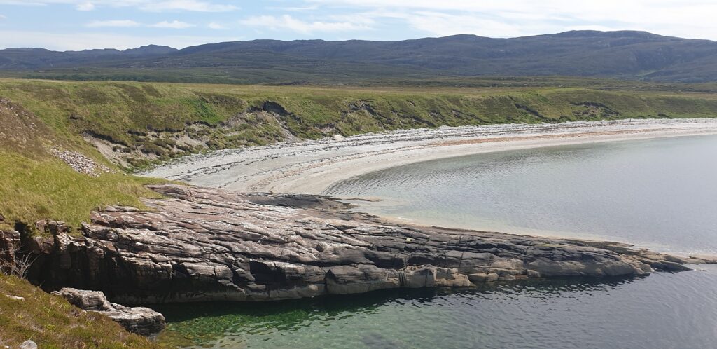
Assynt im äußersten Nordwesten Schottlands ist im wahrsten Sinne des Wortes atemberaubend. Die Landschaft ist so außergewöhnlich, dass man meinen könnte, man sei auf einen anderen Planeten gereist.

Der felsige Gipfel des Cul Mor, einer der höchsten Gipfel in Assynt, bietet nicht nur wunderschöne Ausblicke, sondern auch einen Einblick in die Geschichte der Entstehung der umliegenden Landschaft. Cul Mor, was so viel wie “großer Rücken” bedeutet, erhebt sich von Knockan Crag im Osten und überblickt Loch Sionascaig und den benachbarten Gipfel Stac Pollaidh im Westen.

Trotz seiner größeren Höhe ist er weniger bekannt als seine beiden anderen Nachbarn, Suilven und Stac Pollaidh, aber da er höher liegt, hat man von hier aus einen herrlichen Blick auf diese und andere Nachbarn sowie einen weiten, atemberaubenden Blick bis zu den Summer Isles.

Details zur Wanderung: 13 km – Aufstieg 670 m, Abstieg 670 m – Gehzeit 5 h–5,5 h

Just before the summit of Cul Mor

  • 1 Day Walking Adventures

Categories
Updates Walks and Treks

May 2021 – Day Walks around Ullapool

We are delighted to offer 1 Day Walking Adventures “Walks around Ullapool” (within 45 minutes drive maximum) on a monthly basis.

New for this year and going forward we are offering some fantastic 1-day walking adventures. Ideal for those wanting to get out into the hills around Ullapool and further afield with a qualified mountain leader providing a safe and fun day out.

We will mix each week with difficulty levels from easy to hard and will outline the week regularly on our BlogFacebook and Instagram pages in advance.

All groups will be run with a maximum of 1:7 Guide to client ratio.

More walks will follow and we add them every week. Here you can read more about each walk and book straight online 24/7.

May 2021

DateDayWalk NameWalk DetailsDifficulty
05/05/2021WednesdayCuileig & Gleann Mòr circuit4.5 miles, 7.5 km – Ascent 210 m, Descent 240 m – Walking time 2.5 hLevel 1
06/05/2021ThursdayBraebag and the Bones Caves8.5 miles, 13.75 km – Ascent 650 m, Descent 650 m – Walking time 4.5 hLevel 3
07/05/2021FridayQuinag and a magnificent ridge walk6.5 miles, 10 km – Ascent 750 m, Descent 750 m – Walking time 4.5 – 5 hLevel 3+
08/05/2021SaturdayExplore the highest Waterfall in Scotland with 658 ft (200 m)9.4 miles, 15 km – Ascent 840 m, Descent 700 m – Walking time 5 – 6 hLevel 3+
09/05/2021SundayCul Mor, one of the highest peaks in Assynt8 miles, 13 km – Ascent 670 m, Descent 670 m – Walking time 5 hLevel 3
10/05/2021MondayAlong the Coffin Road to Clachan Church6.5 miles, 10 km – Ascent 400 m, Descent 450 m – Walking time 3.5 hLevel 2
11/05/2021TuesdaySuilven with a cycling and walking approachWalk details: 3.2 miles, 11 km – Ascent 515 m, Descent 515 m- Walking time 3 – 4 h, Ride details: 9 miles, 14.5 km – Ascent 115 m, Descent 115 m – Cycling time 1.5 hLevel 3+
12/05/2021WednesdayCulnacraig to Blughasary via the Postie Path7 miles, 11 km – Ascent 500 m, Descent 500 m- Walking time 3.5 – 4 hLevel 2+
13/05/2021ThursdayBeinn Enaiglair – the gateway to the west8.5 miles, 13.5 km – Ascent 650 m, Descent 870 m – Walking time 5 hLevel 3
14/05/2021FridayHanda Island Explorer Day4 miles, 6 km – Ascent 150 m, Descent 150 m – Walking time 2 h
Level 1
15/05/2021SaturdayBen More Coigach from West to East7 miles, 11 km – Ascent 620 m, Descent 730 m – Walking time 4hLevel 3
16/05/2021SundayBeinn Dearg Loop and the ‘famine’ wall12.3 miles, 20 km – Ascent 1066 m, Descent 1066 m – Walking time 7 hLevel 4
17/05/2021MondayUllapool Hill and Beinn Eilideach Loop8 miles, 13 km – Ascent 575 m, Descent 575 m – Walking time 5 hLevel 2+
18/05/2021TuesdayCul Mor, one of the highest peaks in Assynt8 miles, 13 km – Ascent 670 m, Descent 670 m – Walking time 5 hLevel 3
19/05/2021WednesdayLoch Toll an Lochain, a Corrie not to miss6.2 miles, 10 km – Ascent 270 m, Descent 380 m – Walking time 3 – 4 hLevel 2+
20/05/2021ThursdayCulnacraig to Blughasary via the Postie Path7 miles, 11 km – Ascent 500 m, Descent 500 m- Walking time 3.5 – 4 hLevel 2+
21/05/2021FridayQuinag and a magnificent ridge walk6.5 miles, 10 km – Ascent 750 m, Descent 750 m – Walking time 4.5 – 5 hLevel 3+
22/05/2021SaturdayAlong the Coffin Road to Clachan Church6.5 miles, 10 km – Ascent 400 m, Descent 450 m – Walking time 3.5 hLevel 2
23/05/2021SundayMagnificent Sandwood Bay9.5 miles, 15 km – Ascent 360 m, Descent 360 m – Walking time 4.5 hLevel 2+
24/05/2021MondaySuilven with a cycling and walking approachWalk details: 3.2 miles, 5 km – Ascent 515 m, Descent 515 m- Walking time 3 – 4 h, Ride details: 9 miles, 14.5 km – Ascent 115 m, Descent 115 m – Cycling time 1.5 hLevel 3+
25/05/2021TuesdayExplore the highest Waterfall in Scotland with 658 ft (200 m)9.4 miles, 15 km – Ascent 840 m, Descent 700 m – Walking time 5 – 6 hLevel 3+
26/05/2021WednesdayHanda Island Explorer Day4 miles, 6 km – Ascent 150 m, Descent 150 m – Walking time 2 hLevel 1
27/05/2021ThursdayUllapool Hill and Beinn Eilideach Loop8 miles, 13 km – Ascent 575 m, Descent 575 m – Walking time 5 hLevel 2+
28/05/2021FridayMagnificent Sandwood Bay9.5 miles, 15 km – Ascent 360 m, Descent 360 m – Walking time 4.5 hLevel 2+
29/05/2021SaturdayStac Pollaidh at sunset2.75 miles, 4.5 km – Ascent 470 m, Descent 470 m – Walking time 2.5 -3 hLevel 2+

2021 – Walks around Ullapool

We take full payment for the day walks at the time of booking. All payments will be 100 % refundable until 24 hours before the walk starts. This should give you enough flexibility regarding COVID-19.

We offer a reduction of “Adults” tickets for groups from 2 onwards and two different Family tickets for 4 & 5 members.

All Walks around Ullapool can be offered as a private departure. We can tailor-make you any day walk you prefer within a 1h 30 min drive from Ullapool. This includes Torridon, Dundonnell, Gairloch, Assynt and parts of Sutherland.

If you have any questions please feel free to contact us via Whatsapp, Facebook, email or phone call.

Pricing 2021

1 Adults (16+) – From GBP 35 pp
2 Adults (16+) – From GBP 30 pp
3 Adults (16+) – From GBP 27 pp
4 Adults (16+) – From GBP 25 pp
(Tier Pricing is only for one booking of up to four Adults)

Children (7 – 15) – From GBP 25 pp
Concession (65+) – From GBP 25 pp

Family Ticket 2 Adults 2 Children – GBP 110

All McKenzie Mountaineering – Guided Walking Adventure walks and courses are limited to 7 places, to give you a great experience and to minimise our impact on the environment.

Categories
Northwest Highlands Walks and Treks

Walking in Ullapool and surroundings

In this blog “Walking in Ullapool and surroundings” we describe 5 shorter walks. Each of them is a maximum of 20 minutes drive or starts within the village.

Along the River Broom

A delightful river walk, starting from the T-junction and bridge towards Loggie. You can make this walk as long or as short as you like.

A great time to do this walk is in the springtime when the bluebells begin to bloom, but any other time of year offers a serene and relaxing setting.

Inverbroom estate has done a fantastic job with bridges, stairs and signs for the various pools within the river. There are so many choices for a lovely dip into the refreshing (cold) water.

Short walks in Ullapool
Corrie waiting patiently
Ben in deep thoughts in a very tranquil scenery

The beauty of walking Ullapool Hill or Meall Mòr

This short but relatively strenuous walk from Ullapool gives great views over the village and across Loch Broom in one direction, and in the other direction, towards the surrounding hills and high mountains which offers a totally different experience.

Although short, it is rocky and muddy underfoot in places boots are highly recommended.

There are plenty of benches to stop at and enjoy the view out to sea and towards the Summer Isles on the paths towards and up and down Meall Mòr.

View towards the Golf course and Morefield.
Activites in Ullapool
Loch Broom as it best.

Lael Forest Circuit

If you are just looking to go for a stroll with some gorgeous views over Beinn Dearg in the far distance, this walk has it all in just under two hours.

You start at the Walkers car park for Beinn Dearg and make use of the forest tracks and two old connection tracks (now a path) to do a loop within the woods.

View over to Beinn Dearg
Ullapool Community Trust, locally organised Lael Forest Walk Group

Walking through the history of Geology at Knockan Crags

This trail brings the geology of the Moine Thrust to life as the path climbs past the exposed rocks and up onto the top of the Knockan Crag.

From here there are spectacular views over Assynt towards Cul Mor, Cul Beag and Ben More Coigach. The trail includes sculptures and poetry and places to sit and enjoy the views.

A fairly easy trail to follow, if you go clockwise there is a steep but short ascent to the top of Knockan Crags. From there on the path is meandering nicely above the Crags all the way back to the car park.

Horne and Peach discussing their findings.
Rosie walking along the top of Knockan Crags

Dùn Canna Fort and Camas Mòr/Camas Beag beach

A delightful coastal walk to Dun Canna, a large Iron Age fort situated on a promontory at the foot of Ben More Coigach. There are beautiful views west to the Summer Isles and east along Strath Canaird.

The cliffs protecting the fort and overlooking two pebble beaches are stunning and a great place to explore for a family walk. This can be a day’s outing – enjoying the walk, inspecting the fort, picnicking, bathing and beachcombing.

The path, which follows the River Canaird, is easy to follow but can be sometimes a bit more hands-on and muddy in places. Depending on how much rain has been the days before.

Nevertheless, it is a great fun outing with only 1.5 miles (maximum 1h) to walk each way.

Walking in Ullapool
Walking in Ullapool

For more information about walking in Ullapool or what the area around Ullapool can offer, please send us an email.